GoodRoads

Several years ago I participated project GoodRoads. Team of ten people worked on the geoinformation system. The core idea of GoodRoads is measuring road quality during driving. It uses the accelerometers built in mobile devices like smartphone or tablet.

Design a geoinformation system that measures road quality using mobile device (tablet or smartphone) and a mobile app to provide this information to users.
Summary
I worked on: Service design
Web design
Company: GoodRoads

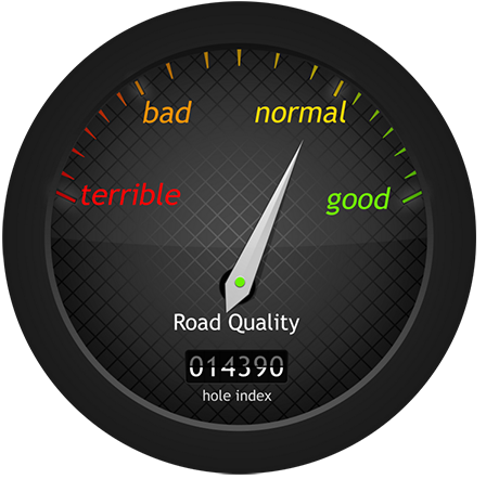
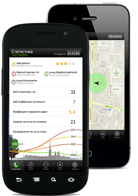
The idea of measuring road quality by using mobile device like a tablet or a smartphone and built-in accelerometer was completely new. GoodRoads project was noticed by such companies like Google, Yandex, Opera and participated a lot of competitions and conferences.

Roads

Quality of roads is a big issue in Russia and that is why this service can be useful there. Basically the app was made for drivers who are interested in improving roads or just for people who want to know how to drive with better road.

I worked in a team of people mostly with technical background. One of the things that I was responsible for was graphic design. Indeed, I made the video below to explain the idea of the app.

better to watch with sound

One more option in your auto

GoodRoads is the cutting edge way of monitoring road surface condition. The mobile app installed on the Android or iOS device collects the data and sends it to the datamining server which processes data and gives it to the web server visualizing it for the user. Unlike existing methods - expert evaluation and aerial inspection, our method is rather cheap and well-rounded.

The GoodRoads App

Besides the manifest functionality of showing the potholes for the user on the map, GoodRoads Project team prepared for the users interesting statistics and genuinely innovative game element.

The app collects data about the road surface condition using the built-in accelerometer. Any bump gives the appropriate data and the device sends it to the server. On the server side the pattern classification algorithm recognises the potholes and shows the user potholes on the nearest roads.